What is TCRBR Project?
The Tompkins County Rural Black Residents Project (the TCRBR Project for short) merges history, genealogy, census records, and maps to spatially contextualize the stories of rural black residents in Tompkins County between 1820 & 1870.
Within this website you will find:
Census lists (based on the federal censuses) focused on the county’s black residents.
Graphs detailing the black population’s growth (or decrease in some areas), birthplaces, & occupations.
Interactive demographic maps.
Interactive maps detailing the approximate locations where black residents lived.
Genealogical, historical, & other related research resources.
Website citation:
Dickerman, Ethan. 2020. The Tompkins County Rural Black Residents Project. Research/Database. The TCRBR Project. May 25. https://www.thetcrbrproject.net.
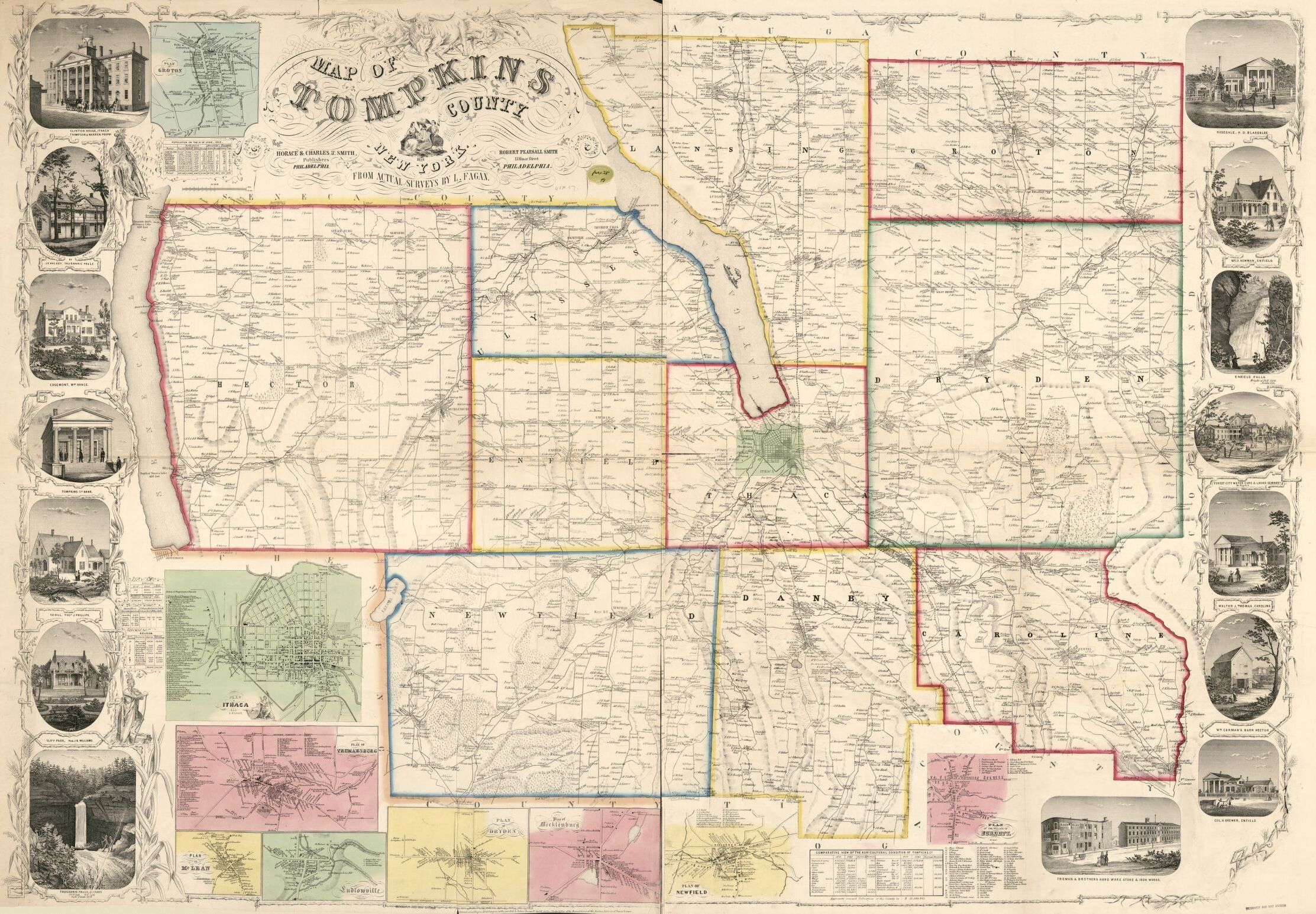
Above: Image of the 1853 Smith & Fagan map of Tompkins County, NY. Sourced from the Library of Congress’s Digital Archive.
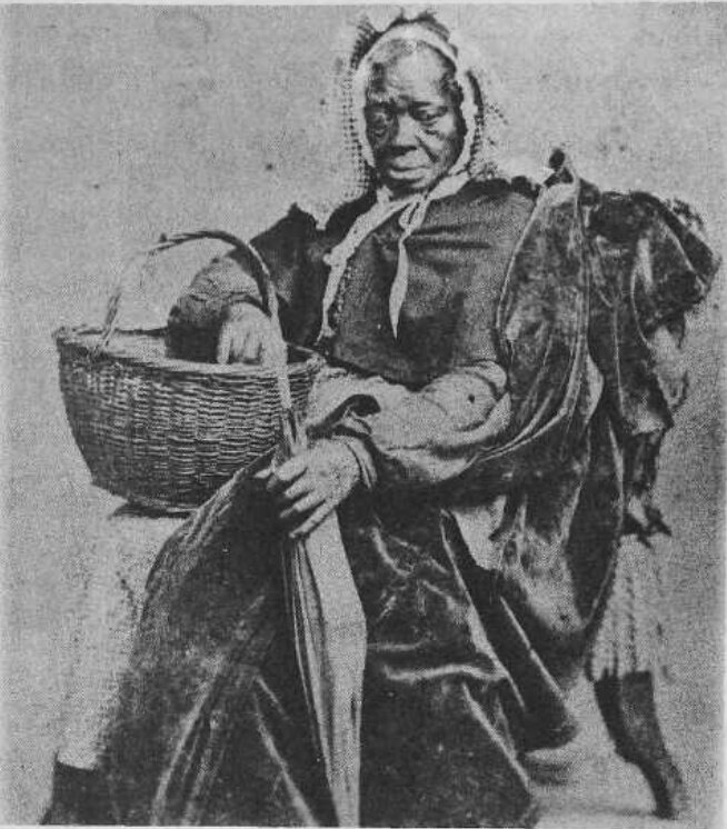
Above: Image of Aunt Elsie Brooks, a freedom seeker from Maryland, who settled in Ithaca, NY at 24 Wheat St (presently 130 Cleveland St). More information available at The Southside Loop & the History Center. Image Courtesy of the History Center of Tompkins County.
Project Background
The TCRBR Project creates a spatial and temporal context for black residents between 1820 & 1870 in Tompkins County. To do this, the project brings together, historical maps, census records, & other documentation, to reconstruct aspects of life for black residents in the 19th-century.
This project emerged from several previous projects undertaken by different people in different parts of NY:
The interactive Land Division Index in Germantown, New York, a continuing project led by Professor Christopher Lindner and his students from Bard College. Users may select property parcels to learn their history, including past owners, residents, and how parcels changed through time.
The History Center of Tompkins County’s project called History Forge, an interactive digital mapping project lead by Bob Kibbee and Eve Snyder, PhD.
Background continued…
This project recognizes that meaningful genealogical, historical, and statistical data exists in archives that are often underutilized, dispersed, and at times in obscure and hard to locate places.
This project recognizes that both federal and state census records, maps, church records, wills, probates, letters, and materials, when brought together, can help tell lost, forgotten, or purposefully silenced stories.
This project also recognizes that mapping where Tompkins County’s black residents lived in the 19th-century is a useful tool for academic research, genealogical research (the latter being geared towards descendants), and as a general education tool for anyone who wishes to learn more about historic maps, census records, and county’s past residents.
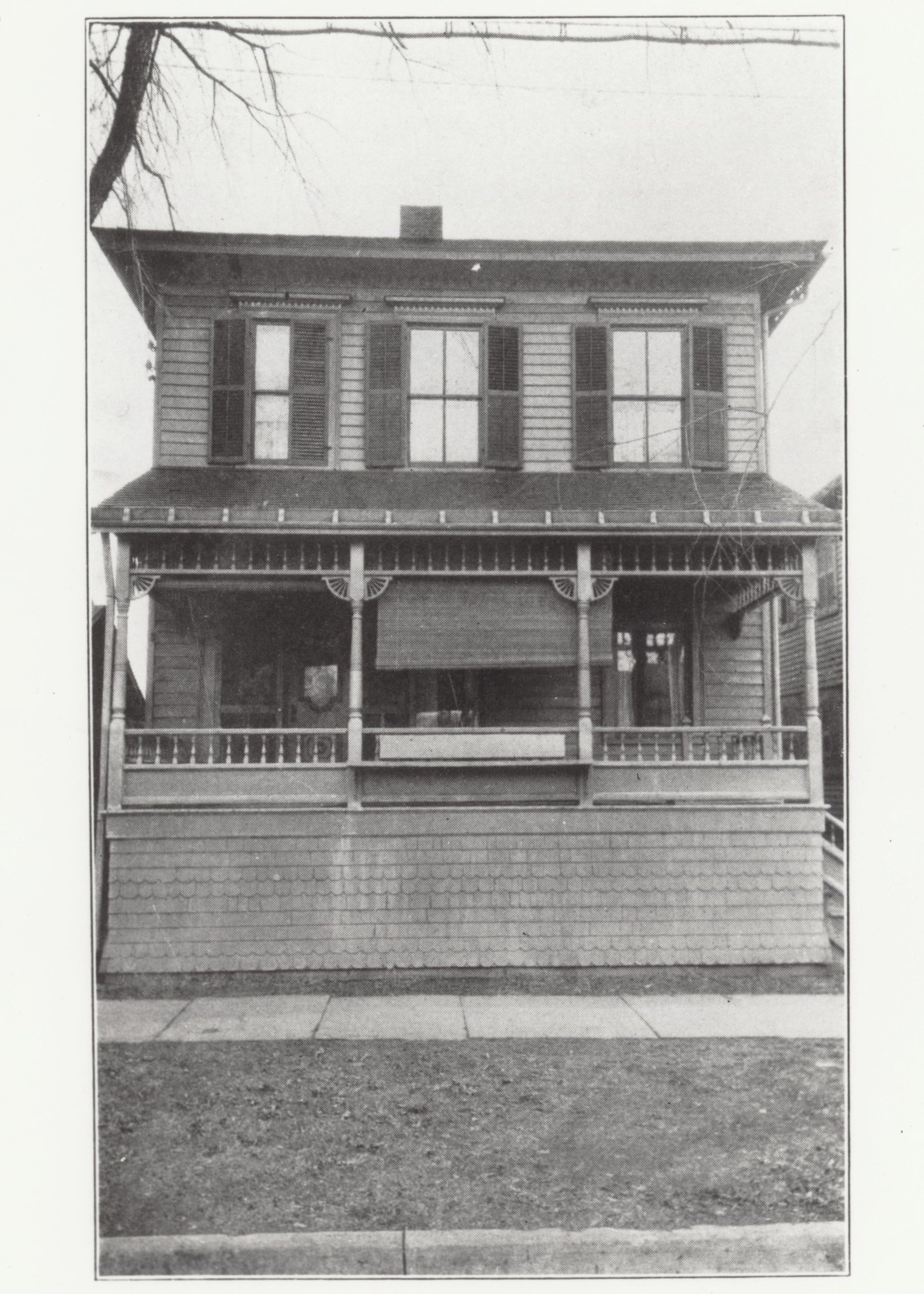
Right: Image of the Dennis-Newton House, 421 North Albany Street, Ithaca, New York. Location where Alpha Phi Alpha fraternity, the first African-American fraternity, was established in the United States. For more information please see Historic Ithaca’s page on the Dennis-Newton House. Image and information sourced from Historic Ithaca.
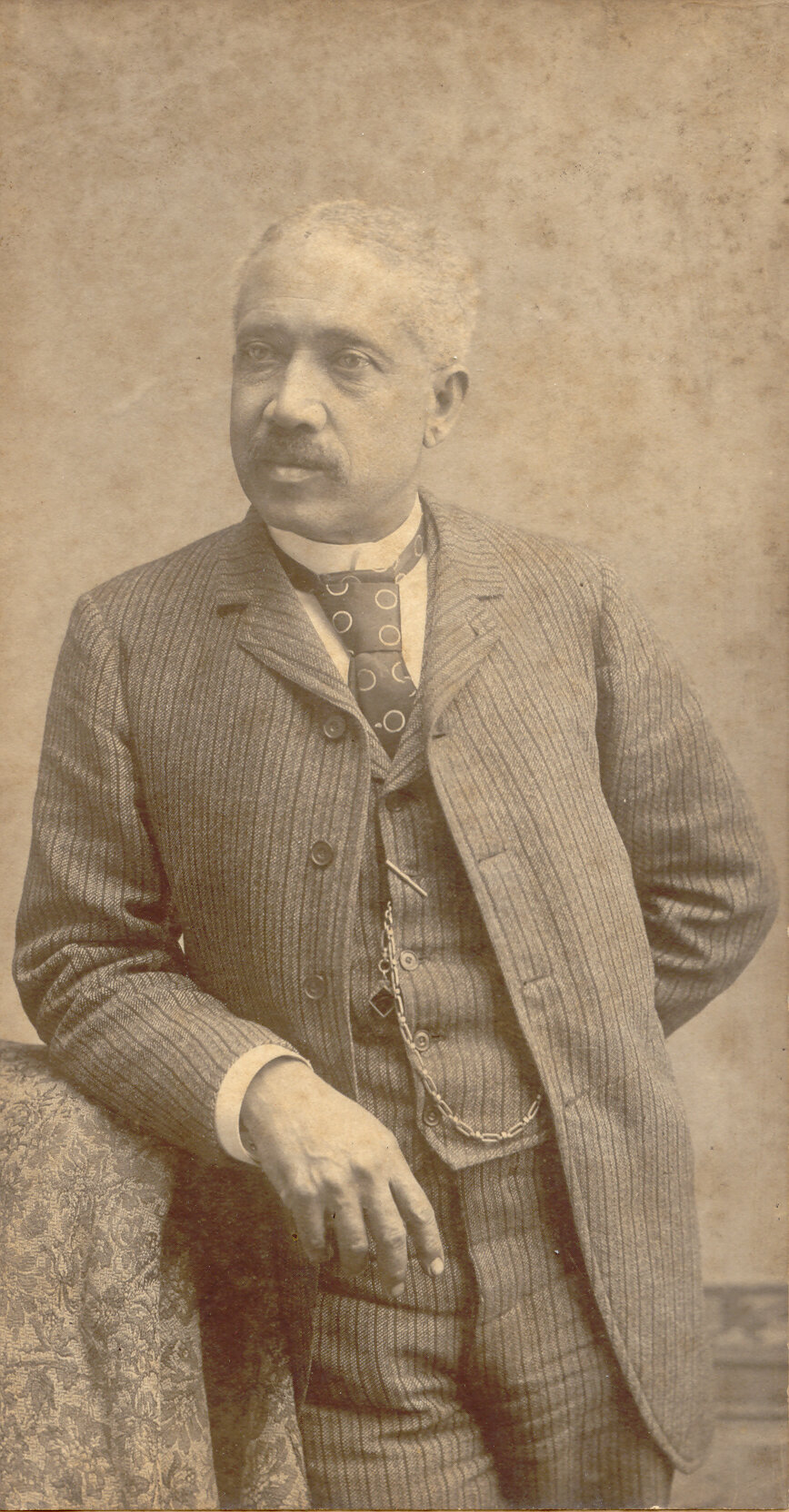
Above: Image of George Johnson, a local barber, and conductor on the Underground Railroad. Courtesy of the History Center of Tompkins County.
Acknowledgement:
Gerard Aching, Ph.D.: Cornell University
John Colón, MA: Savannah College of Art & Design Alumnus
Cheyenne Cutter: Bard College Alumna
Donna Eschenbrenner: History Center of Tompkins County, Director of Archives and Research Services
Frederic Wright Gleach, Ph.D.: Cornell University
Carol Kammen, Tompkins County Historian
Bob Kibbee, History Center of Tompkins County, HistoryForge Project Manager
Christopher Lindner, Ph.D.: Bard College Archaeologist in Residence & PI at the Germantown Archaeology Project
Eve Snyder, Ph.D. History Center of Tompkins County, HistoryForge Project Coordinator
Anu Rangarajan, PhD: Cornell University
Adam Smith, Ph.D.: Cornell University
Students of the 2021 Spring Rural Humanities Course at Cornell University
William Hecht’s “1866 Tompkins County Atlas” https://www.cayugagenealogy.org/maps/1866tompkins/index.html
The residents of greater Ithaca
Library of Congress
And to all others unlisted, whose help and support made this project possible.